 Riverside Fire Authority Volunteer Station #5 had visitors this weekend. Team member Jim Pace brought a great group of new hams, recently licensed through his Volunteer Examiner program, for a tour on Saturday afternoon. We had the opportunity to show them the K7CEM repeater as well as the 100 ft. antenna tower outside the facility. Jim took the time to explain how the repeater system works and answered questions. A repeater can be a strange looking piece of equipment to new hams.
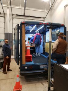
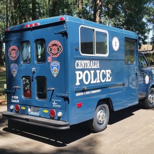
Most of the time, however, was spent in Comm II and around Comm IV, our communications trailer. After demonstrating the on-board equipment and radios, we spent a considerable amount of time discussing the mission of the Centralia Amateur Radio Emergency Service team, and how we train. As the area was under a flood watch this weekend, questions naturally turned to the Chehalis River, Skookumchuck River, and China Creek, our normal sources when flooding occurs.
Our next scheduled training period for Centralia ARES will occur only two days after the Station #5 tour and we will be visiting five different flood monitoring locations in Centralia. The new hams were invited to join us on the training and learn more about how floods occur, local planning to mitigate stream flow, river gauges and how ARES members volunteer during local flooding.
After the Station #5 tour, the new hams also visited Chuck, W5KAV, for a tour of his wonderful ham shack and antenna farm. Later, they stopped at Don’s house, AI7CE, to see his ham station under construction. What a great way to introduce those new to the hobby to the equipment we all use.
 It is November. Along with days and days of heavy rain, comes our first flood warning. While this didn’t turn out to be much, it is certainly a reminder of what is to come over the next few months. For some of the new team members, it is their first opportunity to locate and understand Centralia’s Emergency Response Divisions. After one of our past “100 year” floods, emergency managers realized parts of Centralia could be cut off from each other if the Skookumchuck river, the Chehalis River and China Creek all rose at the same time, resulting in five separate “divisions”, possibly inaccessible for up to 48 hours.
 Annually thousands of Washington residents take part in the Great American Shakeout, a well rehearsed training scenario dedicated to teaching everyone how to safely respond to earthquakes. With training dates flexible for this event, Centralia Amateur Radio Emergency Service (ARES) team members selected Monday, October 18th – their normal training day – for this year’s earthquake exercise. The scenario, based around the 6.8 magnitude 2001 Nisqually quake, brought the team together to practice working with our relatively new Community Situation Status Tracking forms.